West Dog's Teeth
- SamJackWebster

- Jun 25, 2020
- 3 min read
Updated: Sep 7, 2021
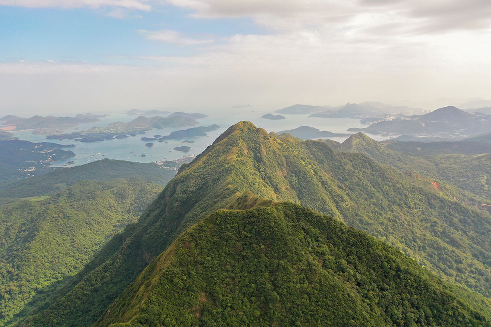
Often referred to as Hong Kong's HARDEST HIKE, West Dog's Teeth is certainly one of the more challenging adventures to be found in HK's mountains. Saying that, I've come across more physically and mentally taxing hikes here so don't be put off by its reputation. Your quads will burn, but if you're fit, it should be manageable, even for the less experienced hiker. This trail is an alternative route to Lantau Peak and takes you along the west ridgeline of the mountain, finishing at the Ngong Ping cable cars and Big Buddha.


Hike Location: South Lantau Island, Shek Pik Reservoir
Hike Difficulty: Moderate-Difficult (6/10)
Hike Length: 5-6 hours
High Distance: 8km
Elevation Gain: ~850m
TIPS: Bring enough water. I'd recommend 2L minimum per person, especially if you're attempting this hike during the hot, humid summer months. I've been caught out on this hike before and had to ration my sips as I approached the peak.
To get to the start of this hike, make your way to Shek Pik Reservoir on Lantau Island via public transport from either Mui Wo Ferry Pier or from Tung Chung MTR station. Photos 1+2 show where you should be dropped off (by bus or taxi), the stop being known as the Shek Pik Police Stand Bus Stop.


Next you need to walk back up the road (North-East) for 5 minutes until you reach the Tong Fuk Catchwater on your left.


Follow the concrete path until you reach the catchwater. Cross the bridge and follow the Shek Pik Country Trail.


After 30 minutes or so you'll reach a large stone on you right marked with danger signs and Chinese characters. Dauntingly or promisingly, depending on your disposition, this is where the adventure begins.


From here you can expect continuous steep incline with some light scrambling work. It's a serious climb, but still manageable by those without previous climbing experience.


At times the ridgeline drops off to your left or right but there are no real life-threatening moments and the path is always wide enough so that you feel safe and well-balanced. Some may find this testing in a strong wind or in cloud, so pick your day.


Eventually the ridgeline joins with Lantau Peak's and the path becomes grassy and even more steep. This is where your muscular endurance will be tested the most: it's a straight 200m incline to the Peak.


After passing large rocks to your right, you'll come out onto the Lantau Trail (photo's 27+28). Follow it up for another 20 minutes to reach the top of Lantau Peak.


If you're following the map attached below you'll notice we didn't go up to the peak on this occasion. The clouds were low and the extra effort wouldn't have been rewarded with views. But on a clear day it's definitely worth the additional burn. The views over Lantau and the South China Sea are incredible. The photos below are taken from the top of Lantau Peak on a clear day.


If you do summit, then after the peak, retrace your steps back to the intersection and take the route down to the right (photo 33). After 45 minutes of quad-challenging granite steps, you'll eventually reach the archway in the final photo. From here on, follow the path and signposts back to Big Buddha and the cable cars. Enjoy!


See the route I took on the MAP below (green dot is the starting point) and download the KML file to see the route in Google Earth 3D. Watch my KML tutorials for downloading the map on both laptop and mobile.


Below is a screenshot from the Google Earth KML file.


Comments